SKI-NZ 2016
March 19, 2016
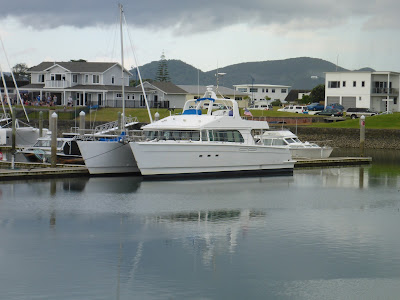
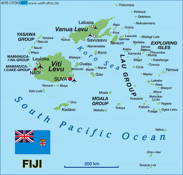
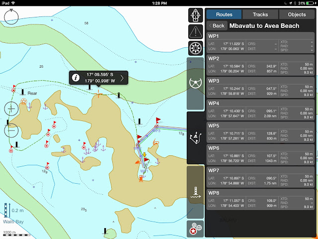
Great Barrier Island , New Zealand
The Kiwis love their outdoors and their sports, and when it comes to fundraising for a good cause, why not do it on a wave runner?
Hence, the
Yamaha Ski-NZ 2016, a fund raiser for the N.Z. Melanoma Foundation.
Twenty-nine riders, seven days, 650 km around the top of New Zealand, and over $90,000 raised.
Invited by Jeremy Burfoot, DOMINO was only too excited to jump in the fun and be the support boat.
![]() |
| The Route: Opononi (Hokianga) - Ahipara - Parengarenga - Mangonui - Russell - Tutukaka - Leigh |
![]() |
DOMINO's route, from Opua to Opononi/Hokianga
260 NM of leisurely cruising, dodging weather |
The route was from Hokianga on the west coast to Leigh on the east coast, and “over the top” of Cape Reinga and North Cape.
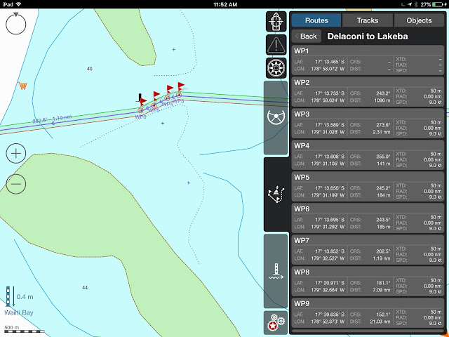
While the riders got to the Hokianga by road, on their trailers, DOMINO had to get there by sea, starting from the Bay of Islands.
It was a beautiful trip, dodging the finicky weather that is notorious at the capes, but we discovered stunning landscapes.
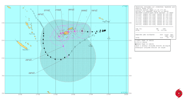
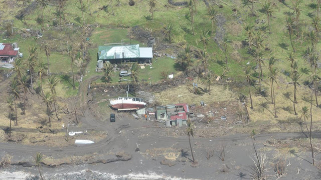
Feb. 25 – Paradise Bay (Bay of Islands) to Horsehoe Bay (Cavalli Islands)– Hurricane Winston had just run amok over Fiji and the 3-meter swells from the NE were a challenge to contend with, especially at anchor. Bonus: our friends on MAUNIE (last seen in Fiji) happened to cruise by and we managed to drop the dinghy and visit for a short while until we all wanted to get out of the damned swell.
![]() |
| Fueling up in Whagaroa... could not have made it to the fuel dock without the help from November Rain |
Feb. 26 –
Cavalli Islands to Whangaroa – or WOWangaroa… no sooner had we passed the head of Whangaroa bay entrance we were in a green paradise, with volcanic lava domes peaking out of green forests.
We found calm anchorages at last, dozens of nooks and crannies to recuperate our balance.
There again, we caught up with friends, the Tennant Powercat “November Rain.”
Garry and partner Lori had just won 3
rd place at the national Penn fishing tournament, 1
stplace at the local gamefishing club, and Gary was keen on giving us all tips on fishing… oh, and how to get to good anchorages, how to safely cross the bar in Hokianga, and how to best navigate “over the top.”
In the end, we both fueled up and Garry and his shipmates escorted us all the way to North Cape.
![]() |
| Sunset at KariKari Beach... weatherman said no wind till tomorrow... gale blew through at 2 AM |
Feb. 29 –
Whangaroa – Cape kariKari – With a NE gale advisory on the forecast for the next day, we decided to duck on the west side of the Cape, while Garry opted to stay on the east side, expecting a calm night.
The gale came through at 2 in the morning, gusting at 36 knots, and we were tossed out of our bunks by the chop.
Meanwhile, the 100-ton steel trawler "Lady Lola" that was night fishing not even 2 miles north of us was thrown on the rocks and just lolled there, its 7 passengers wearing life jackets, hoping for the best, ready for the worst.
It was maddening to be in sight of the Lady Lola and not to be of any assistance.
The gale was raging, it was pitch dark, and the skipper had assured us that he was in no immediate danger. At dawn, the “Florence Nightingale” was steaming down from North Cape at full speed, and with the winds down and the tide high, managed to refloat the "Lady Lola," miraculously with only a few scrapes on her bottom.
Meanwhile, "November Rain"’s passengers were a bit green around the gills as they made out of their anchorage.
![]() |
| Tom Bowling Bay, North Coast. |
March 1 –
Kari-Kari – North Cape – Tom Bowling Bay– I expected the north coast to be very rugged and rocky.
Instead, we found lovely, long beaches and safe anchorages.
Which was a good thing as the forecast was announcing more high winds from the SE.
We simply waited for the weather to pass, as it always does in these parts.
![]() |
Malcolm Tennant Powercat "NOVEMBER RAIN" at Tom Bowling Bay
Thanks, Garry and Lori for sharing all these beautiful anchorages with us |
More fishing for snapper, kingfish, trevally, blue cod, and encounters with hundreds of dolphins were enough to make us happy.
As the chop swirled into Tom Bowling, we searched for a better anchorage and found it at Piwhane Bay were none other than Garry was already sheltered, bottom fishing for John Dory!
![]() |
| Rounding Cape Reinga |
March 4– Piwane Bay – Cape Reinga – Ahipara – At last, the wind had dropped below 15 knots from the SE, the seas had calmed down, and we had a glorious rounding of the notorious Cape Reinga, the northern most point of New Zealand. I expected clashing, pyramidal waves, having listened to the lore of sailors who battled this cape, but all we found was strong currents and splendid views.
![]() |
| 90-mile beach.... you can drive on the beach... 4-wheeling in the sand dunes |
Then, it was a ride down the 90-mile beach, along the immense sand dunes, by the rock with a hole in it, and –with 25 knots blowing where there was supposed to be no wind (is the weather forecast ever right in NZ?) – we ducked into the wide bay of Ahipara, again amazed at the beauty and peace of the landscape.
![]()
March 5 – Ahipara – Hokianga (Opononi)– We dreaded this part.
Hokianga is a bar harbor.
Only the week before, a boat had taken the bar in the wrong spot and had broached.
How were we to do this?
I had tried to get the harbormaster in various channels, by email, on the Coast Guard website, on the Hokianga Tourism website, no dice.
In the end, it was Annette, the operator on Far North VHF Radio, who got me the phone number of Pete, the harbor warden.
Just a call, and we had agreed on the best time to come into Hokianga: 0700.
Cruiser's note:
FAR NORTH RADIO: VHF Ch. 60 on the East Coast,
VHF Ch. 61 North Cape to Three Kings,
VHF Ch. 83 on the West Coast
Hokianga Harbor Warden (Pete) -
021-405-872Cell phone reception is null from North Cape to Cape Reinga to about 5 miles North of Ahipara.
![]() |
| Sand dunes at Ahipara... walk them up, sand-board them doown! |
We rose early, having a 2 to 3 hour ride, depending on weather.
We expected 25 knots of wind and rough seas… we got ZERO knots and flat seas… is the forecast ever right in NZ???
![]() |
Green track... north of that, breakers will roll you over; south of that, it's all rocks and breakers
Brown track on exit |
Pete called us on our cell phone, directed us to were he wanted us to cross, and just guided us in as we glided on a mirror!
![]() |
| Opononi, on the Hokianga... lovely! |
Sunrise in Hokianga is just breathtaking, with its sand dunes, wide estuary, green banks, jutting pine trees.
![]() |
| Evening on the Hokianga |
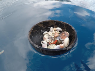
Once more, we dropped anchor, dropped a line, caught snappers for lunch, and pinched ourselves at the beauty of the New Zealand coastline.
![]() |
| #111 Brendan Grant - #3 Richard Cook - The ultimate Yamaha setup |
But that was enough for our leisurely cruise. The Riders were coming in and it was time to get into high gear.
![]() |
| Trevor and his 2 sons.... What a team from Lake Taupo! |
THE GUYS – AND GALS --- They came from all parts of New Zealand, but also from Australia and New York, 27 guys, 2 gals. Some are couples, some are brothers, all are friends, lead by the fearless Jeremy Burfoot.
![]() |
Burfoot
The Ultimate Melanoma Survivor |
All are avid waverunner riders. The 3 groups may have been labeled “advanced,” “Intermediate,” and “beginner Intermediate,” this was no ride for beginners. If the weather was to be what we had endured with DOMINO on our way in, a challenge was definitely on the horizon!
![]() |
| Dewey Dawn Deck Duty! |
March 6 – Hokianga – Ahipara -
We raised anchor at dawn, ready to cross the bar by 0800, once more on glassy water.
![]()
Bar? What bar?? From his house over the entrance, Pete watched us cross and texted us goodbye!
![]() |
| JP Waiting for the skis |
![]() |
| What a sight in the early morning light! |
We slowly motored, waiting for the riders who were scheduled to leave an hour later, and peered over the silver mirror of the flat sea, not a wave, not a breath of air.
And suddenly they appeared, hovering over the surface, jetting past us in a wink.
![]() |
Is that one of the Terry Boys on his hoverboard?
|
DOMINO kicked up to speed and was only too happy to steam along at 20 knots while I shot hundreds of photos. It was a magic morning, thanks to the benevolent weather gods.
![]() |
One of the Terry boys....
|
While the land crew retrieved the skis on the beach, JP and I were curious to find out what were the fish that were schooling all around us. Soon we had pulled 6 Kahawai, considered by some as bait fish. “Not bad smoked,” advised Tom, cruising by on his jetski.
![]() |
OK... can't keep track of them!!! Oh! #41 - Russell Bailey, of course!
|
![]() |
| Smoked kahawai... easy done in 2 hours |
And so it was that 2 hours later we had smoked and packed the Kahawai, ready to auction at the auction night! But for tonight, not going to shore.
It wasn't always easy to differentiate between the riders streaking along the coastline and the rollers breaking on the rocks. In the open, the radar picked up the echos and our binoculars did the rest. But wherever there were breakers, we had to look very closely and search for our riders.
They came for their pictures and I had so much fun clicking away, thankful for digital media instead of the old film process! But if you ask me for their names, I have been able to identify only a few of them...
![]() |
| #21 - Green team - Who is Rogers BS???? |
March 7 – Ahipara – Cape Reinga – North Cape – Parengarenga -
![]()
Could we ever be so lucky?
Again, no wind, flat seas, heavenly conditions for a ride “over the top.”
While the road crew was peering down from the Cape Reinga lighthouse or from the beach, cheering their riders, the riders played in the surf all along the 90-mile beach and Cape Reinga, took a lunch break on their machines along the coast, refueled at sea, and assaulted North Cape in the most ideal conditions.
![]() |
| Jeremy Burfoot on his Awesome Yamaha ride |
We lost sight of them at Parengarenga.
There was no way for us to enter this harbor, only 2 meter depth over moving sandbars… not for us.
We kept on to Cape KariKari where we knew we would be sheltered.
Not going to shore for us tonight.
![]() |
| Burfoot at Cape Reinga |
![]() |
| Matapia Island... hole in the rock by another glassy morning |
![]() |
JP never looses sight of his riders
or at least, tries to! |
![]() |
(Burfoot) "Hey, JP, slow down!"
|
![]() |
The Red Team: Invincible Armada
|
![]() |
Burfoot on the prowl at Cape Reinga
|
March 8 – Parengarenga – Cape KariKari – Mangonui -
![]() |
JP: "Where is the Green Team?"
|
![]() |
| GoPro on the helmet! Nice! |
It was to be a late start, so JP and I went trolling around KariKari … a dozen skipjack, a hundred dolphins, no tuna, but still no wind and glassy seas. How long would our weather luck hold?
![]() |
Around North Cape
|
Not long, as it turned out. By noon, we were sighting the first group at Cape KariKari, and the wind freshened up, soon to reach 20 knots, and a nasty chop was kicking the riders sideways. We had a hard time sighting them, the whitecaps throwing us for a loop. Whitecaps? riders?
![]() |
| Our ducklings... Even the radar picks them up.... |
We were keeping track of the groups as they zoomed by: the red hot-doggers, the yellow who wanted to prove themselves as good as the red, and the green…. Oh, where were the green?
I logged on the
SPOT tracker page, and it showed the green team way behind, somewhere along the bay west of KariKari, but not moving very much.
Was anything wrong?
These guys are usually gung-ho, ready to eat miles of ocean at high speed.
![]() |
| Burfoot counting his chickens... |
Darth Vader Jeremy, black-suited, mounted on his police-white Yamaha, was concerned.
The green group was lagging.
Soon, we had to make some calls.
Could a road crew have picked up a rider in trouble anywhere along the way?
Our calls on our designed VHF Ch. 77 remained unanswered.
![]() |
| The Yellow Group in formation... "Who's going for their picture now?" |
At last, I put an all-station call on Far North radio and hailed “Mango Moon,” a friend of ours who was cruising north of KariKari.
“Mango” stayed put and kept watch.
![]() |
| Russell Bailey |
Our friend Lisa on "Mango Moon" was sick with worry and kept her binoculars trained on the bay. Soon, Lisa and Frank gave us some relief: “They’re in the cut!”
From the flybridge, I finally spotted them and Jeremy, who had been sidling to DOMINO for the last half hour, made a beeline for the riders.
![]() |
BLowing 20 knots now, side chop, more difficult conditions...
Jeremy is relieved to see the green group appear.
Meanwhile, Far North Radio traffic announces that the red group has arrived in Mangonui |
Turned out they were doing what they said they would do: enjoy the marvelous scenery of Cape KariKari.
Can’t blame them: they were in sheltered waters.
Now that they had found the nasty chop on the east coast, it was a straight line to Mangonui.
![]() |
| Mangonui Harbor at sunrise |
Mangonui is a very busy fishing harbor and JP had the challenge of finding a spot for BigD in cramped quarters and shallow water, not good holding, strong reversing tides. Settled at the bottom of the harbor, we watched the sun go down, backlighting the splendid silhouette of Mangonui’s quaint harbor. No going to shore for us tonight!
March 9 – Mangonui – Russell–
![]() |
| The dramatic rocky coast off Whangaroa |
The wind instrument read 4 knots out of the SE; seas were slight… our luck was back! And what a ride this was!
![]() |
| The rocky formations around the Cavallis |
The coast is chock-full with islands to poke in and out of. Berghan Point, Motutara Island, Bird Rock and the Te Umukukupa Peninsula, Stephenson Island, Frenchman Rock, Flat Island, The Cavalli Islands, so many fun rocks to zoom to and fro!
![]() |
| "The Finger" rock |
![]() |
| Here they come again... and they're saying, "Here's that damn boat again!" |
We watched the riders zoom at the bottom the cliffs, surf the beach waves, go through holes in the rocks, and just have a jolly good time until the sky covered and the rain caught us as we were turning into Russell. Certainly, this was the most fun day… or is every day just better than the previous one?
![]() |
| I never tired of watching them coming... these riders are amazing! |
Russell – we’ve been here before, we know the lay of the land, and yes! We’re going to shore tonight. It’s auction night.
Before dinner, I went around the terrace, talking to diners. A lady was moved: she is a 12-year survivor.
![]() |
| Historical hotel on the waterfront |
The Duke of Marlborough is quite the venue, historical hotel on the waterfront, perfect to watch over DOMINO while we were having a great dinner and a bit of fun.
Our sponsor from GURIT came by and we were thankful that Tony Stanton, now chief engineer for Gurit Asia Pacific, designed such a strong and capable boat.
![]() |
| Under the umbrella of love... Al and Vix and sister |
Dinner-auction was a success, even our smoked Kahawai raised a bit of $$.
And we got to mingle with some awesome people… but not for long.
We had to regain the boat and ready for the next day’s run, Russell-Tutukaka, while the riders would take a day’s rest in Russell.
![]() |
| Cape KariKari was a challenge well met! |
March 10 – Russell-Tutukaka - No wind, covered sky, slight seas, and we’re trolling the 150-200 meter line, hoping for tuna… not a thing, and I’ll leave it at that! We dropped anchor in the shallows of Tutukaka harbor and JP went to shore to make the final preparations for tomorrow’s trip to the Poor Knights Island.
![]() |
| MOre KariKari chop |
March 11 – Tutukaka-Poor Knights Islands – Tutukaka -- For once, the riders would have to do without DOMINO.
This was a day for the road crew and families.
![]() |
| Jetting it up along the coast |
Since DOMINO was too big to enter the marina, the
Tutukaka Marina had kindly allowed us to dock at the fuel dock to pick up passengers and lunches.
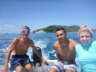
Interestingly, the man who caught our dock lines asked us what this rally was all about, then lifted his shirt and showed me a scar on his back: MELANOMA SURVIVOR, 6 years!By 10:30 we had 24 passengers, all strapped in their life jackets, ready for a fun day on the water.
We’d never had so many people on board, but it was quite a pleasure to share DOMINO with such a dynamic group.
![]() |
| Riko Riko Cave... we're supposed to get DOMINO in there!!!! |
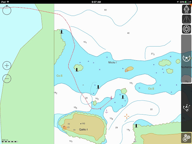
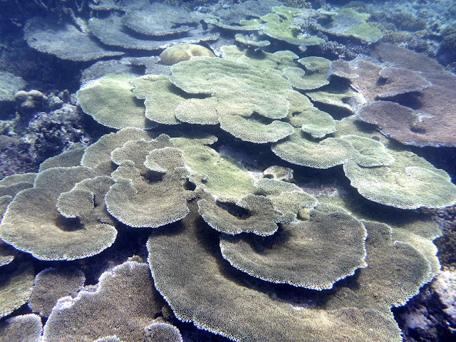
Poor Knight Islands is a marine reserve, renown for its spectacular diving, and location of the largest sea cave in the world, the RikoRiko cave: 130 meter wide, 80 meter deep, 30 meter tall. The objective? Get DOMINO inside the cave!
![]() |
Little Princess Sophie and her grandparents,
all a family support team... |
Flat seas on the way, that was good… a slight chop in front of the entrance, that was not so good.
VIDEO OF DOMINO ENTERING THE CAVE can be seen on the Facebook post, thanks to
https://www.facebook.com/TrevTerryMarine/videos/1087732514582490/![]()
My heart was racing, and I’m not sure that JP was breathing, but, from the flybridge, he had a perfect command of his ship and got us in there… followed by the waverunners.
![]() |
| Riko Riko, the largest surveyed sea cave in the world. |
![]()
And echo?
Oh yes, DOMINO’s horn inside the cave sounded long and strong!
Slaps of congratulations to JP who dropped anchor in a secluded cove so we could all have lunch together.
![]() |
| From inside the cave.... now, we'll have to get out of here! |
![]() |
| The riders joined us for lunch, reunited with their loved ones for a very nice time on the water |
![]() |
| "OK, guys... line up behind me for a photo!" |
![]() |
| VICKY!!! That's the spirit! |
![]() |
| Brett Kettle |
![]() |
| Damian, our official M.C. and entertainer, clowning around his helmet |
![]() |
| Matt Cotton |
![]() |
| Terry, a bit of Tahiti with us |
It was a time for pictures!!
![]() |
| Brian Nicholas - Enjoying sunshine in front of Middle Arch |
Now, JP had ridden a waverunner before, but when Brock Terry loaned him his machine, he was catapulted in a whole new dimension… try to compare a Formula I race car to your run of the mill street car!
![]() |
"NO, Marie, we will not let you go! Will not let you go! Will not let you go!"
(Continue... "Scaramouche... will you do the Fandango?")
|
Beaming from ear to ear, my guy regained the ship and ordered to raise anchor.
![]() |
"Hey Marie!! Did you get that in picture?"
|
![]() |
| The riders leave, we're stuck at anchor! |
Uh-oh… chain won’t come up! Wiggle this way, that way, forward, reverse, no dice.
Kindly, passenger Matt donned mask and snorkel and checked it out: too deep. Time for JP to go for a scuba dive: yes, the chain has slipped in crevasses between boulders, 17 meters below. One, two, three twists and we’re free! Not a bad day, JP!
![]()
That evening, we kept an eye on the weather.
Strong wind advisory from 02:00, gusting at 35 knots.
We anchored DOMINO in a more protected spot and waited.
Sure enough, middle of the night brought gusts at 37 knots and a chop in the harbor.
We were not looking forward to next day’s ride.
![]() |
| Sunset in Ahipara... west coast delight... |
March 12 – Tutukaka to….???? By 07:00, it was still blowing 25kts in the harbor, 35 outside. Boats trying to go out were turning around. One sailboat made it out and was disappearing in the troughs, its mast barely visible.
![]() |
| Jeremy and Russel return from their recon ride... looks nasty to us! |
Would the guys dare to ride?
JP was adamant, he was not taking DOMINO in these conditions.
Jeremy and Russell made a recon foray into the roiling surf.
What would the decision be? Ride or not ride?
We were pretty sure they would not go to Leigh, a punishing ride.
But, lo-and-behold, there they were!
Almost the whole fleet was scooting past us, waving, into the nightmare.
![]() |
| Jeremy leads the way out of Tutukaka |
Needless to say, we turned up our VHF on Ch.77 and 16, made sure our phone was charged, DOMINO ready to go if needed, and logged on to the SPOT tracker. There they were, hugging the coast, mindful of the nasty rocks along the Tutukaka coast, past Tutukaka Head, past Bream Head, and into Marsden Cove. What a relief to see all tags out of the water and not on their way south to Leigh.
Was that a punishing ride? Nobody will admit to it, but I’m pretty sure it was wicked!
![]()
And just like that, the ride was over, our friends gone on their way (Nationals in Lake Taupo this weekend.)
I can’t imagine a better time, better people, all rallying for a good cause, and we were glad to be a part of it.
Thank you to the friends who sponsored us, GURIT, other cruisers, melanoma survivors… $90,000 for melanoma research, education and treatment will go a long way.
![]() |
| Bye Bye.... |
BUT WAIT!!! THERE"S MORE!!!! As if this last day had not been dramatic enough, as the riders got into Marsden Cove, they came across a boat on fire. Fortunately, the 2 adults and 4 children on board were rescued on time. I'm posting these terrible images as a reminder that fire is the worst thing that can happen on board. Every boater must be prepared to douse the fire or jump ship. (Photos Richard Cook)
![]() |
| First, the smoke |
![]() |
| Then, the all-engulfing fire |
For me, the serendipitous encounters with survivors made the point: melanoma is curable if caught early. Through this trip, I held the memory of the very first patient we lost, in 1981, a father of 2 in his early 40's, gone within 4 months of his initial diagnosis; I held a thought for Dina, the last case that JP diagnosed in 2004, a beautiful young woman in her early 20's, now a survivor; I cherished the thought of Dave, our son's best friend and a son to us, who was diagnosed as a child, also a survivor; and thanked the stars for our dear French Buccaneer F. who, now in his healthy 70's, is also a many-years survivor. We advocate public education, early detection, the search for new treatments, and the all-important patient support. To the many who contributed to this fund raising effort, our most heartfelt thanks.
DONATIONS to the N.Z. Melanoma Foundation can be made HERE
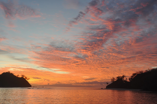
![]() |
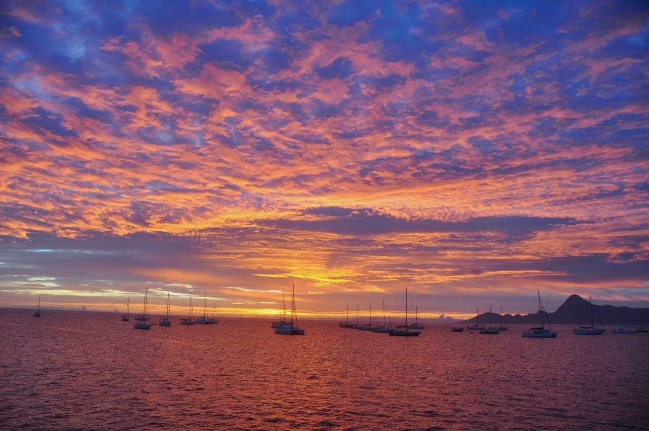
| Another spectacular West Coast sunset... Opononi |
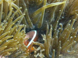
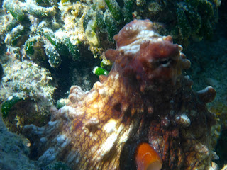
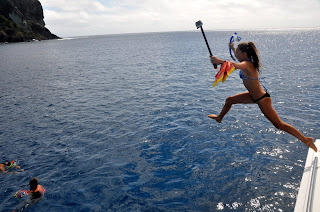
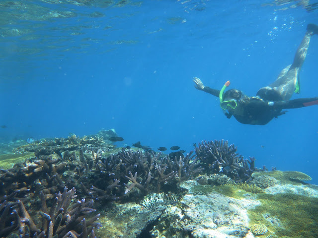
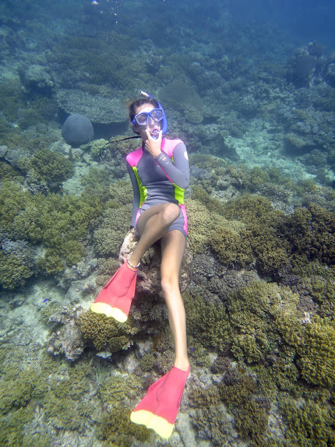
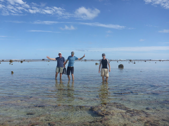
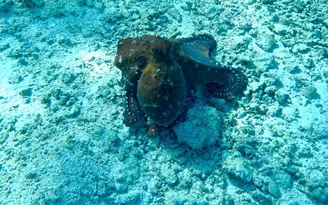
Two days later, the weather had returned to windless, sunny days and flat seas and we hopped on El Tigre to dive The Poor Knights with
Dive Tutukaka. A spectacular day!
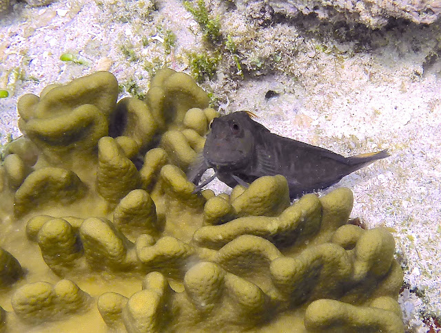
![]() |
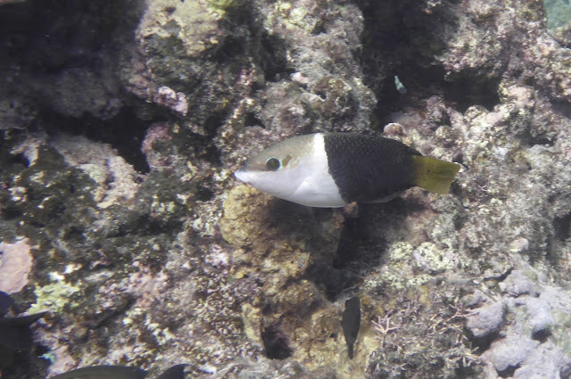
| Blue-eyed Triplefin |
We love New Zealand, but it’s time to get ready to go back to Fiji, work on the recovery of the islands devastated by Cyclone Winston. Until next time…