VANUA BALAVU - West and North
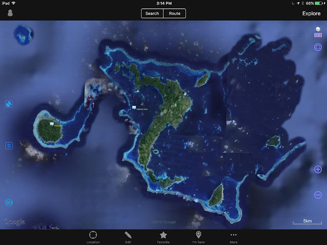 |
| Vanua Balavu, Northern Lau Group, Fiji 3 passes: Qiliqili to the NW, Adavaci to the W, and Tongan Pass to the SE |
*** Disclaimer — These navigation notes have been gathered from many sources as well as from our own experience. After Cyclone Winston, we can expect that many navigation beacons and marks have disappeared. We can also expect that, in some places, the coral beds have been damaged and perhaps re-arranged. The litter and rubble in the anchorages is unknown. Use the provided information using your own discretion, and keep a sharp lookout. Do not navigate inside the lagoons and passes in poor visibility. ***
Note that DOMINO draws 1.2 meter (4') -
QILIQILI PASS (NW PASS)
 |
| Qiliqili Pass (NW end) |
- Photo 1 - Vanua Balavu - General Location of Northwest pass entrance (Qiliqili)
(NOTE - iSailor files may still be available for download on my Google Drive )
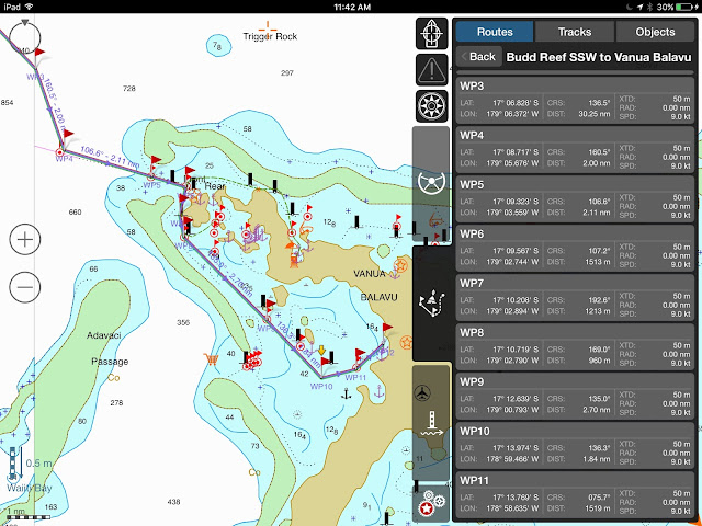
- Photo 2 - Vanua Balavu NW Pass (Qiliqili) to Delaconi village - Waypoints 3-11
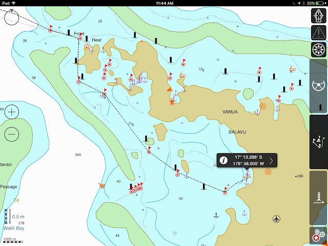
- Photo 3a - Vanua Balavu - Domino’s track from Qiliqili Pass to Delaconi anchorage
** CAUTION ** Be mindful of the small reefs when approaching the village - The holding at Delaconi village is marginal, lots of rocks and rubble. It is rolly in any SW to NW condition. Then, a better anchorage can be found just west of the airstrip.
- Photo 3b - Delaconi - Airstrip anchorage
 |
| A bit of a dingy ride to the village, but the "airstrip" anchorage is popular in westerly conditions |
Getting to shore by dinghy, look for the small opening in the reef, not wide but present at low tide… not no much worry at high tide.
ADAVACI PASS (SW PASS)
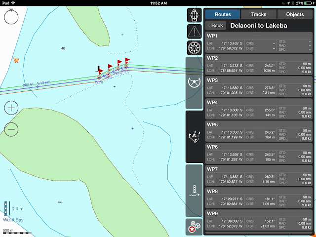
- Photo 4 - Vanua Balavu - Adavaci Pass (SW) - Waypoints 1-7 - This is a straight shot west of Delaconi Village. One of the reasons while the anchorage is rolly in westerly conditions, but a quick way to get out. At any rate, only advisable in calm and clear conditions as there are bits of reef to be avoided.
Photo 5 - Vanua Balavu Adavaci Pass (SW) - Detail - WP 3-6
(The orange food cart denotes good fishing!!!)
BAY OF ISLANDS
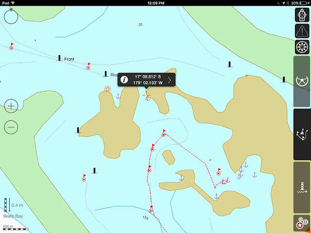
When the anchorage in Delaconi gets too rolly and windy, the Bay of Islands (BoI) offers good protection from most directions. Some yachts may find it hard to anchor in the 17-20-meter depth, but the holding is good. With a bit of poking around, you can find shallower spots.
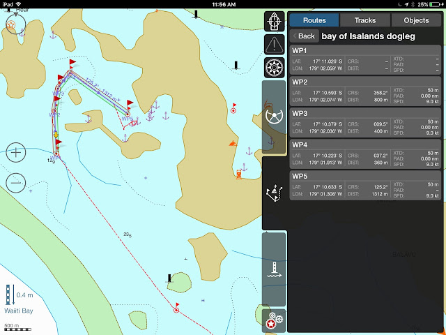
To get to the BoI anchorages from Delaconi, we found it safer to track back towards Qiliqili Pass and enter the "dogleg" track. Always trolling a couple of lines, always catching a Sierra (Spanish Mackerel) or two!
We've seen some yachts take the shorter "inside passage", but only with excellent visibility and 2 lookouts on deck, and it's a gutsy passage I would't try. S/Y Rewa did it and we watched them hesitate and backtrack between rocks and reefs!
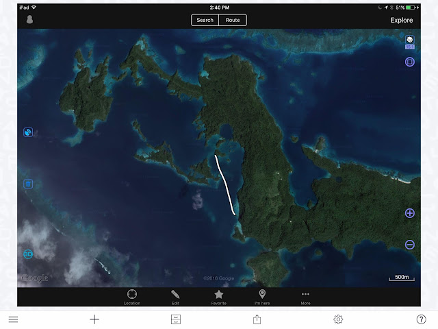 |
| The "Inside Passage" to the BoI - Not recommended! |
Photo 6 - Bay of Islands “Dogleg” and Domino’s track
Photo 7 - Bay of Islands Anchorages - There are many of them in The “Swimming Pool”, but there is no need to be on top of each other. It’s a wonderful area to explore, find the caves, look for the fruit bats, and kayak around. The nook at the northern end is a good overnight spot while waiting for good conditions to exit. Note that the “Front” and “Rear” beacons are most likely gone.
BAY OF ISLANDS TO MBAVATU (PLANTATION)
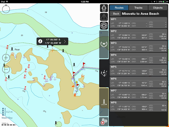
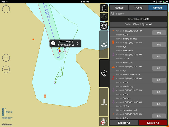
Photo 8 - DOMINO’s track - to enter Mbavatu, use Wpts. 2 and 1
** Note that at the northern end of the island, the reef extends farther out than on the chart. Keep a sharp lookout… most of the marks may have disappeared ***
Photo 9 - Rounding over the top… notice the reefs in the north channel… careful… only do on a clear day!
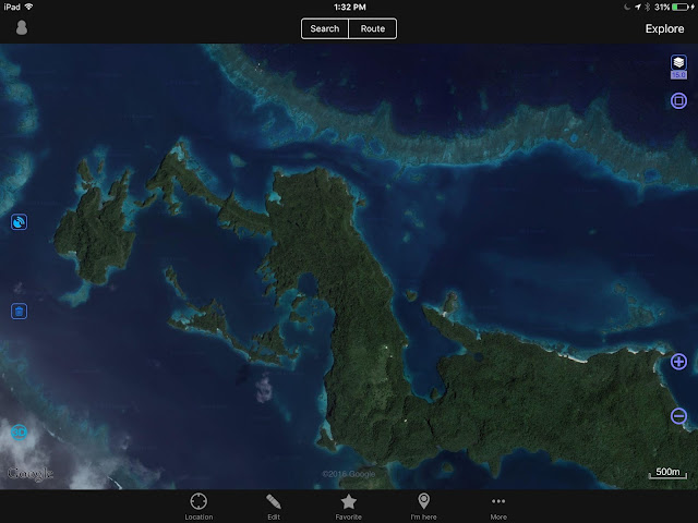 |
| OVITALMAP satellite photo |
Photo 10 - Mbavatu Harbor - There are several anchorages, but the closer you get to shore, the more likely you are to encounter rocks. Also, the anchorage in the NE hook has been proven to get rolly as the rocky shores reverberate and amplify any kind of wave action. We just prefer to anchor smack dab in the middle! The “Yacht Club” moorings on the Western end may be gone, the Yacht Club building too… The Landing is at the bottom Western side of the bay. Just walk up the hill and you should get to the coconut oil plant, or what's left of it. Higher yet is the coconut plantation and workers' village... if still standing.
Photo 11 - Mbavatu Harbor
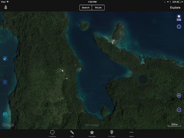 |
| OVITALMAP |
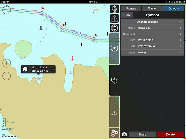
Photo 12 - Horse Bay and Little Bay
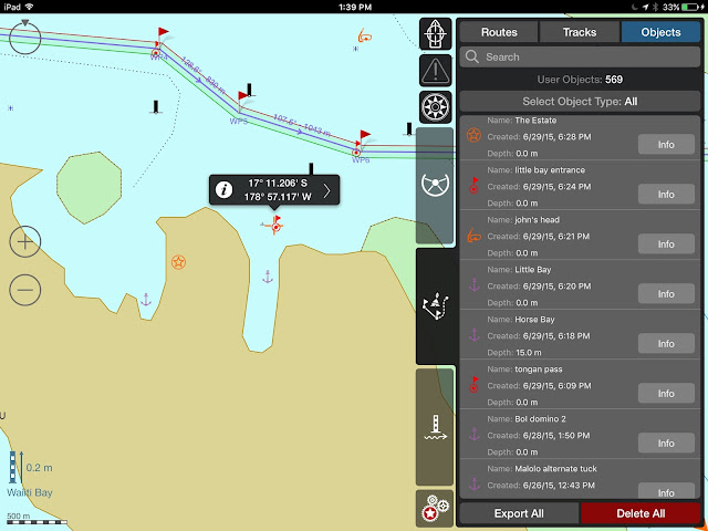 |
| Horse Bay, Little Bay, The Estate and other waypoints |
Photo 13 - Horse Bay “The Estate” was a pig farm. What is left, we do not know. It is possible to anchor - 17*11.527S - 178*57.710 W
Photo 14 - Little Bay - It is possible to enter Little Bay - It used to have good Internet, in straight line from the phone tower, but who knows what happened with the comm. tower? Very secure anchorage, not much room for more than 1 boat.
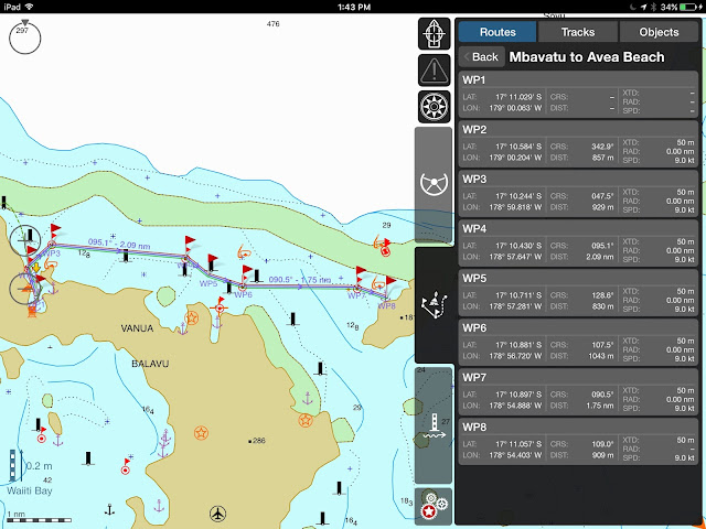
Photo 15 - Mbavatu to Avea - Again, careful of the reef, especially around WP7 -
Photo 16 - Avea Anchorage - Just north of the village, the anchorage can be rolly, and we only stayed one night. The village was so low-lying it’s probably gone.
There is good snorkeling just north of the anchorage and Soggy Paws reported good diving just through the pass
( WPs: dinghy pass Inner 17*10.349S 178*54.429W
dinghy pass Outer 17*10.315S 178*54.447W
Dive spot 17*10.239S 178*54.504W ) What is left?
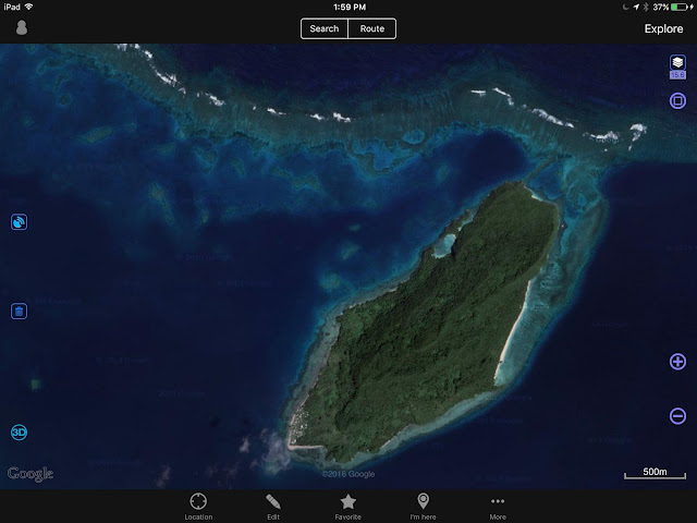
Photo 17 - Avea - The village is located at the SW tip of the island.
till next time
dominomarie

