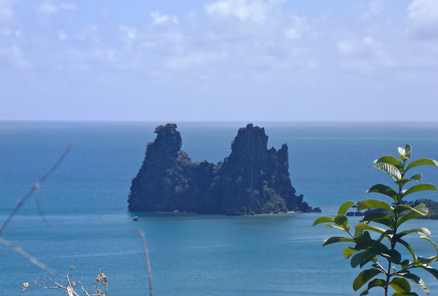
NEW CALEDONIA - East Coast - In search of good holding.
October 2017
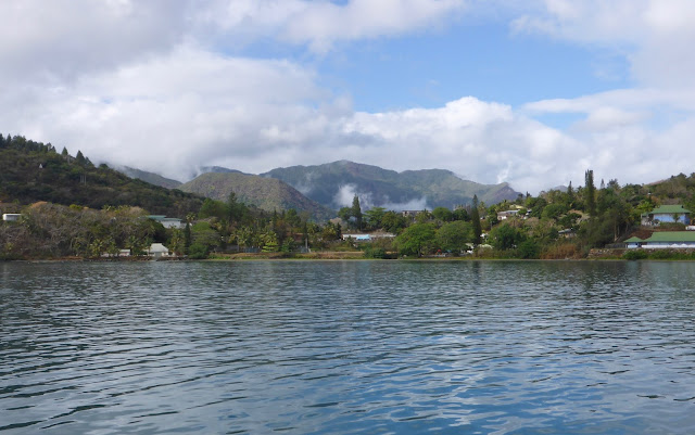 |
| Hienghene - A gem not to be missed |
Circumnavigating New Caledonia is typically done in a counter-clockwise fashion. Since the prevalent trade winds are SE, it’s wiser to cruise northward along the east coast, pushed by the Trades, and travel south along the west coast, sheltered from the Trades. Well, that’s the usual plan. As for the Great North, just look for calm days because there is nowhere to run!
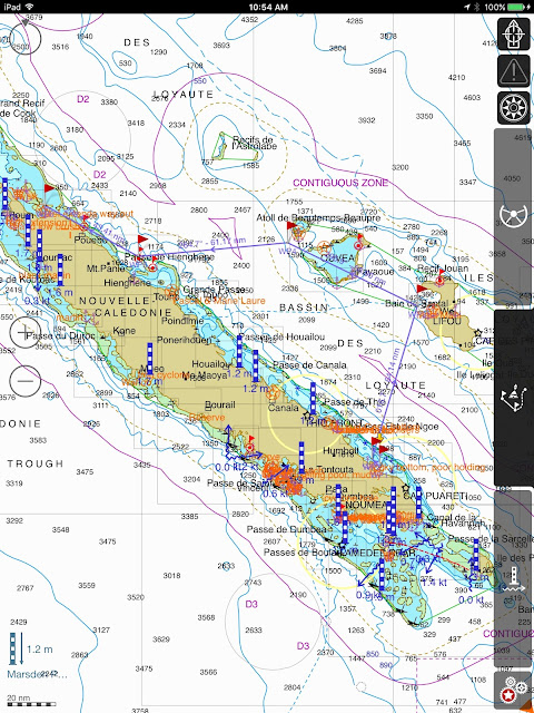 |
| Our route: Kouakoue, Port Bouquet, Lifou, Ouvea, Beautemps-Beaupre, Hienghene, Baie de Pam |
The East coast —referred to as “The Forgotten Coast”— is magnificent: rugged, wooded, with high peaks and rocky shores, dotted with high columnar pines firmly planted in the rich, red soil. New Cal is a prime exporter of mineral, Nickel being the foremost, but also chromite, copper, gold, iron ore, manganese, and silver. For once, I found that the trips ashore were as interesting as the underwater discoveries.
STOPS TO AVOID— Kanak independentists are very active and sometimes violent. they have been known to throw cow carcasses into the harbor in Canala to prevent access to the town. From Canala, bands of activists regularly infiltrate and agitate the surrounding areas, particularly around Mont D’or. During our stay, activists regularly blocked the main road and several times attacked the regular police force and even took aim at the firefighters! Here are the stops you DON’T want to make: Canala and Kouaoua
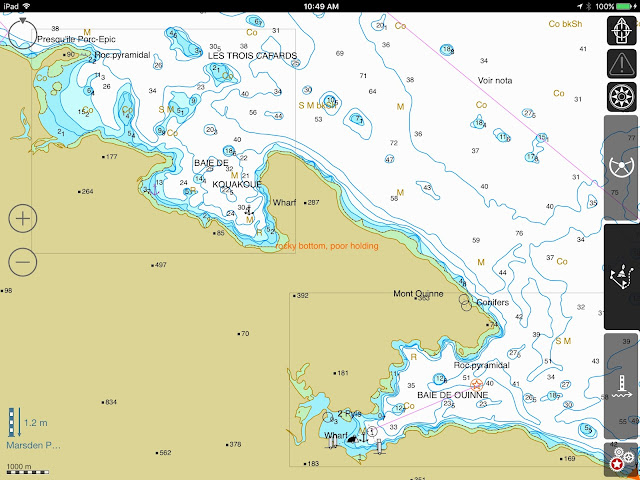 |
| Ouinne and Kouakoue bays |
Stop #1 - KOUAKOUE— (We bypassed Ouinne as the SE wind did not favor that anchorage) For a first glimpse at the Easter Wilderness, this large bay filled us with peace, earthy smells, green slopes and red earth… and a choice of anchoring spots… well… kind of…
- The sandy beach on the eastern side of the bay is private: no anchoring there!
- The southern part of the bay seems to offer great protection from the Trades, but as we tried to set the anchor, we only bit into coral rubble… not good!
 |
| Nice snapper, right? Except that we both got Ciguatera poisoning from it! Better stay away from lagoon fish. |
- The western end of the bay, then! 21*55.804S - 166*38.595E - With the wind staying below 5 Kts, there was little risk of rolling. BAM! The anchor dropped through 8 meters of rust-color water, sunk into the earthy bottom, and just stuck there. Lovely anchorage indeed, and not a soul around… no fish either… but a good overnight stop in Pure Nature.
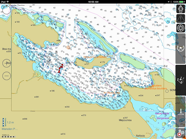 |
| Port Bouquet - Before dropping anchor, scan the bottom! |
Stop #2 - PORT BOUQUET - This looked like a great stop and fishing spot, a lagoon entirely surrounded by reef, and no wind at all that day. That looked like promising snorkeling. Well, don’t count on snorkeling on the East coast. The water is heavy with minerals and visibility marginal. And the anchoring???
 |
| Marbled grouper on the line... uhm.... not to big, will attempt eating it... Ciguatera warning! |
Armed with waypoints and directions, we proceeded to Anse Toupeti, where the depth seemed OK… 10 meters would be perfect, right? But as JP sounded the bottom with the DFF3 Fish Finder, all he saw was peaks and valleys, bommies, coral heads, boulders and rocks, nowhere to drop the anchor.
For hours, we toured the lagoon: Anse Lemia, the north coast of Ile Nemou: it was the same bottom relief: coral and rocks. At least, we trolled around the reef and caught a nice sierra, but still had not found a decent spot to anchor. It would have been great to anchor in front of St. Roch and visit the village, visit the mines… but we didn’t feel comfortable with dropping the hook in rocks and coral.
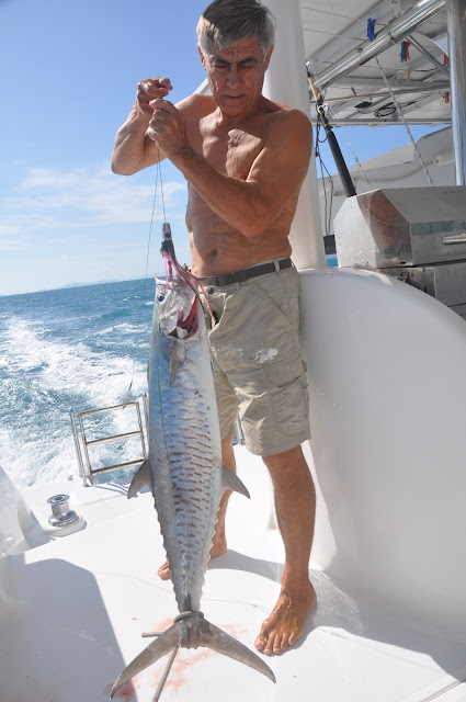 |
| Dog-tooth Tuna: all day long! |
Toupeti:21*41.304S - 166*25.503E -At last, JP wedged DOMINO in a small sandy spot, surrounded by big boulders, and with terrible anxiety I dropped the hook in 3 meters of water, on a short scope, hoping that we would clear the rocks all around us. If the shore was as lush and inviting as could be, the water was not. It was a short night, and the morning saw us escape East, to the Loyalty Islands.
 |
| Hienghene River... Can you say GREEN? |
Stop #3 - Hienghene - 20*41.012S - 164*56.879E - As you know, I’m not a land person and I go to shore as little as possible. Not for me, the trips, trecks, walks, promenades, views from the top… no sireee… I’m a water baby!
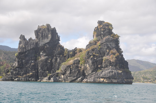 |
| "Tour Notre Dame"... AKA "La Poule" (The Hen) |
But Hienghene got my attention, stole my heart, and I actually went on a 3-hour walk in the hills. It’s a MUST !!!
Drunk with the smell of Niaouli (the local wild eucalyptus) we drunk more: the views on “La Poule,” (the hen-shaped rock that guard the bay), the green lagoon that receives the Chester Cliffs, the green river that snakes all the way into the bay.
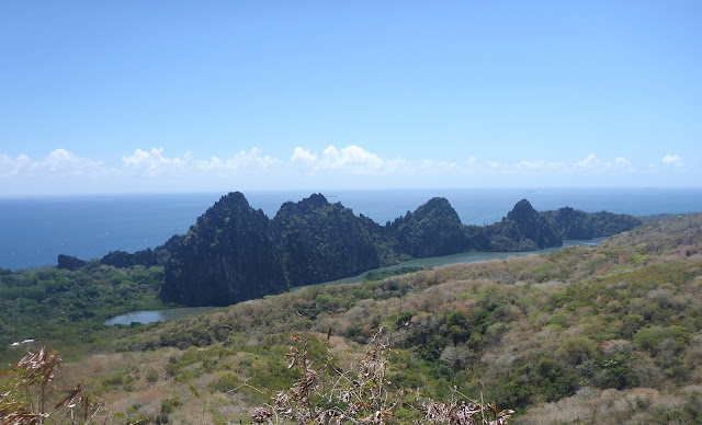 |
| The green inner lagoon inside the Chester Cliffs |
We forgot about fishing and snorkeling again (nothing there) and enjoyed the walk, the small town, a nice meal at the “pension” and a very quiet anchorage.
 |
| Baie de Pam |
Stop #4 - Baie de Pam - 20*14.190S - 164*18.234E - Woops…. the Trades are blowing hard, 20Kts and forecast to reach 30-35! Time to seek shelter. At the northern end of the East coast, the very deep Baie de Pam offers excellent holding and shelter. From Hienhene to Pam, the inner reef channel offers good protection from the swells, and with the wind in our back, the passage was a cinch… and we landed some nice fish: dog tooth tuna (plentiful in the north!) -
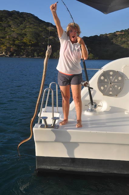 |
| All I managed to catch was a Giant Estuarine Moray |
Well dug-in at the bottom of the 800-meter hill, we waited for the storm. But we were attacked by a storm of another kind: FIRE! What had started as a small brush fire along the road was slowly expanding, and as the wind picked up the entire hill was on fire. Gusts at 30+ were fanning the flames and pushing the smoke towards us. It was an ugly 48 hours, filled with wind and smoke and nowhere to run. That’s the way it goes…
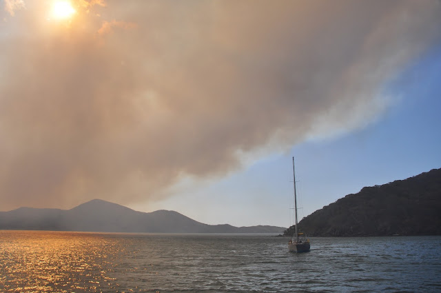 |
| Smoked-out! |
Brush fires are, indeed, a major problem on the islands. “Controlled” burns too often go out of control, the vegetation is decimated, the land bare, and subsequent rain washes out the soil, creates landslides. During our last week in NC, a major landslide occurred on the East coast, killing 8 people. Farmers are active in educating against the slash/burn technique, but it may be too late to save the island.
The wind has died, the fire lingers… and we’re off… to the Great North!
Till next time…
dominomarie
